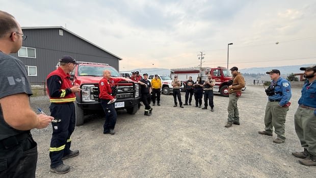
A snowmobile organization in British Columbia is supporting firefighters battling a runaway wildfire near the Coquihalla Highway by sharing valuable local insights. The Mine Creek wildfire, situated between Hope and Merritt along the crucial highway connecting the Lower Mainland to the B.C. Interior, has engulfed an area of 30 square kilometers as of Sunday morning. The wildfire crossed the highway last Wednesday during record-high temperatures, prompting a two-day road closure and evacuation orders for properties along the Coquihalla.
Amid efforts to contain the blaze, the Merritt Snowmobile Club is assisting the firefighters. Simon Rizzardo, the club’s vice-president, mentioned that they have granted firefighters access to their webcams and guided them during tours, highlighting cabins needing protection and recommending trails to use. Rizzardo emphasized the local knowledge advantage they possess due to being familiar with the backcountry throughout the seasons, enabling them to aid in safeguarding structures effectively.
Rizzardo noted that while firefighters may have access to online mapping tools indicating forest roads, local snowmobilers are aware of road conditions, including overgrown or damaged pathways. The club’s webcams have proven beneficial by capturing footage of the fire’s movements, providing critical information to fire crews. Rizzardo expressed his commitment to offering firefighters the best support possible, likening the situation to navigating a foreign environment and highlighting the value of local guidance.
The B.C. Wildfire Service reported a favorable weather shift on Sunday for those combating the Mine Creek wildfire, with lower temperatures and increased humidity aiding in reducing fire activity. However, the forecasted thunderstorms posed a potential challenge, as gusty winds and heavy downpours could intensify fire behavior and create slippery road conditions. Several severe thunderstorm watches were in effect across B.C., raising concerns for crews working in affected regions.
Amanda Graves, an information officer with the B.C. Wildfire Service, mentioned varying amounts of rain and improving visibility in some areas, though smoke cover continued to hinder aerial operations. The risk of lightning persisted in specific fire centers, necessitating ongoing vigilance. Additionally, evacuation orders were issued in the Chilcotin area near Anahim Lake, with residents instructed to leave their homes due to multiple wildfires impacting the region. The Beef Trail Creek and Dusty Lake wildfires covered significant areas, prompting emergency measures to ensure public safety.


